

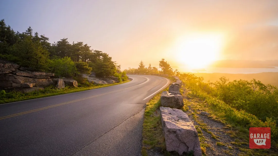
The Blue Ridge Parkway is a 469-mile, two-lane National Park Service road and one of the best mountain driving routes in the US. It runs from Rockfish Gap near Waynesboro, Virginia (Milepost 0) to Cherokee, North Carolina (Milepost 469). For a first drive or ride, choose Mileposts 290 to 317, which cover Blowing Rock, the Linn Cove Viaduct and Linville Falls. This guide takes the Parkway section by section, north to south, for drivers and riders alike, and is one spoke of our Best Scenic Driving Routes on the East Coast 2026 roundup.
How to Drive and Ride the Parkway
Treat 45 mph as the road’s design. The speed limit tops out at 45 mph and drops lower near developed areas. The Parkway almost never straightens out, so the satisfaction comes from linking one curve cleanly into the next. Set an entry speed you can hold through the whole corner and look through to the exit.
Choose your stretch by elevation. The road climbs from 649 feet at the James River to 6,053 feet at Richland Balsam. Higher sections run cooler and can sit in cloud on damp mornings. Plan the high ground for mid-morning or later and bring a layer.
Use the overlooks to manage traffic. There are no stoplights and no billboards. Commercial trucks are prohibited, so the slower vehicle ahead is usually a camper or a sightseer. Pull into an overlook and let the gap open up rather than sitting on someone’s bumper for twenty miles.
Riders, read the edges. Overlook entrances collect gravel. In fall, shaded corners hold wet leaves long after the sun is up. If you’re building a trip around motorcycle rallies in the region, check the dates first, since rally weekends bring more bikes onto the same roads.
Groups, keep it small and spaced. A long line of cars at 45 mph boxes in everyone behind it. Split larger groups into smaller packs and agree on named overlooks as regroup points before you leave. To plan a multi-car convoy road trip with GarageApp, save those stops on the route and share it with everyone driving.
Blue Ridge Parkway Closures: Check Before You Leave
Hurricane Helene hit the North Carolina sections hard in September 2024. Repairs have reopened the road in phases since then. Some stretches between Little Switzerland and Asheville, and spots south of Asheville, have stayed closed or under construction for long periods. Winter weather also closes high-elevation segments from roughly December through March. Rockslides and paving projects add short-notice closures in any season.
- Open the NPS Blue Ridge Parkway Real-Time Road Status map. Closures there are listed by milepost.
- Check the park's official social accounts for same-day updates.
- Note where the closure ends and pick your detour before you lose cell signal.
- Check again the morning you leave. The map changes.
Cell coverage drops out for long stretches, especially south of Asheville. Download offline maps and save each detour as a waypoint before you leave the hotel.
Best Sections of the Blue Ridge Parkway, North to South
Mileposts 0 to 106: Rockfish Gap to Roanoke
The northern section is wooded ridge running with steady sweepers and long views over the Shenandoah Valley. Stop at Humpback Rocks (MP 5.8), the James River overlook (MP 63.6), and Peaks of Otter (MP 86) for lunch at the lodge. For fuel, drop off to Waynesboro, Buena Vista via US 60, or Bedford. Riders: the Bluff Mountain Tunnel at MP 53.1 is the only tunnel in Virginia. It is short and unlit, and the transition from sun to shade can briefly blind you.
Mileposts 106 to 217: Roanoke to the North Carolina Line
South of Roanoke the road opens into farmland and gentler curves with split-rail fences. Take the Mill Mountain spur near MP 120. Mabry Mill (MP 176) is the most photographed spot on the Parkway, and Groundhog Mountain (MP 189) has a lookout tower. Fuel and food are at Floyd via US 221, Meadows of Dan, and Fancy Gap. Riders: expect grass clippings in summer, deer at dusk, and crosswinds on the open ridgelines.
Mileposts 217 to 317: The High Country
This is the stretch to pick if you only have one day. Doughton Park (MP 241) is open meadow. Moses Cone Manor (MP 294) sits above Blowing Rock. The Linn Cove Viaduct (MP 304) wraps around Grandfather Mountain, and Linville Falls (MP 316) is a short walk from the lot. Blowing Rock, Boone, and Linville all have fuel. Riders: the viaduct is fully exposed to wind. Several overlook lots in this section are gravel or have gravel washed onto the paved apron.
Mileposts 317 to 382: Little Switzerland to Asheville
The road climbs hard here, and this is where tunnels start stacking up. There are 25 tunnels in North Carolina. The NC 128 spur at MP 355 leads to Mount Mitchell, the highest peak east of the Mississippi. Craggy Gardens (MP 364) and the Folk Art Center (MP 382) follow. This section took heavy Helene damage, so check status first. Fuel is at Little Switzerland, Spruce Pine via NC 226, and Asheville. Riders: the tunnels are unlit and often damp inside. Lift your visor or swap to a clear shield.
Mileposts 382 to 469: Asheville to Cherokee
The southern section is the highest, tightest, and best part of the Parkway. Stops include Mount Pisgah (MP 408), Graveyard Fields (MP 418), Devil's Courthouse (MP 422), Richland Balsam (MP 431, 6,053 ft), and Waterrock Knob (MP 451). Fill up in Asheville. The next easy fuel is at Balsam Gap on US 23/74 (MP 443), then Cherokee. Riders: it can be 20 degrees colder up top than in Asheville. Fog rolls in fast, so pack a layer.
| Section | Mileposts | Best for | Fuel access | Notes |
|---|---|---|---|---|
| Rockfish Gap to Roanoke | 0 to 106 | Warm-up sweepers | Waynesboro, Buena Vista, Bedford | One short unlit tunnel |
| Roanoke to NC line | 106 to 217 | Relaxed cruising, Mabry Mill | Floyd, Meadows of Dan, Fancy Gap | Deer, crosswinds |
| High Country | 217 to 317 | First-timers, photos | Blowing Rock, Boone, Linville | Windy viaduct, gravel lots |
| Little Switzerland to Asheville | 317 to 382 | Mount Mitchell spur | Little Switzerland, Spruce Pine, Asheville | Helene repairs, many tunnels |
| Asheville to Cherokee | 382 to 469 | Elevation, tight curves | Asheville, Balsam Gap, Cherokee | Longest fuel gap, cold and fog |
Planning Your Blue Ridge Parkway Road Trip
Fall color starts at the highest elevations in early October and works downhill through late October. October weekends are packed, especially around Blowing Rock and Asheville. Summer weekdays are the best-kept secret: green, warm, and nearly empty before 10 a.m.
Give the full Parkway four days, not three. Run it southbound. The road gets better as you go, and the south end drops you near the Great Smoky Mountains, Deals Gap, and the Cherohala Skyway. Coming from the north, you can add Skyline Drive through Shenandoah. It has a lower limit and a park fee, but it makes a seamless 574-mile run. Our motorcycle road trip planning guide covers packing and daily mileage.
Book Blowing Rock and Asheville lodging months ahead for October. Waynesville and Little Switzerland are quieter bases near the best riding.
Group Drives and Rides
Keep groups to five or six vehicles. Cars should leave several lengths between them. Riders should hold a staggered formation with a two-second gap and go single file in tunnels and tight curves. At the posted limit, gaps open naturally. Nobody needs to close them by speeding.
Overlooks are small. Don't park eight vehicles across a lot built for six, and pull through fully so the next group can get in. Our guide to car culture etiquette applies here too. Plan regrouping points at Peaks of Otter, Mabry Mill, Moses Cone, and Mount Pisgah. Each has room and restrooms. GarageApp's Clubs & Groups feature helps you coordinate the crew, and event discovery lists organized runs. You can also find motorcycle meets and group rides near you through the same channels.
Assign a sweep rider or driver who knows the next regroup point. Then nobody has to turn around on a blind curve looking for a straggler.
The Parkway rewards patience more than any road in the East. Map your sections around the current closures and send them to everyone coming. Save and share the route in GarageApp before you head for Milepost 0.